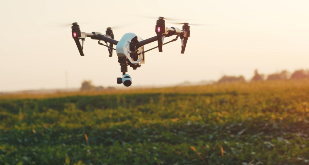
5G networks provide high speeds and bandwidth that allow for many new use cases across many industries that have been lacking reliable connectivity. One of them is the ability to use drones to collect data and then send that data to the cloud for processing. In agriculture, specifically, 5G drone operations enable animal monitoring and tracking, delivery of supplies and objects for commercial use and improved air traffic control under FAA regulations.
Ericsson wants to advance the use of 5G for drone operations in smart agriculture to support remote monitoring and assessment of fields, farms and livestock. To do so, Ericsson is collaborating with the Aerial Experimentation and Research Platform for Advanced Wireless, funded by the National Science Foundation and a consortium of industry partners.
AERPAW is part of the Platforms for Advanced Wireless Research program with a mission to accelerate fundamental research with UAVs using advanced 5G wireless communications and networking technologies.
The collaboration demonstrated how to use 5G and drones to monitor cattle more efficiently. The AERPAW team equipped a custom drone with a connected camera and local compute capacity to monitor grazing patterns. Footage from the remote field was streamed over a 5G connection enabled by an Ericsson base station and Ericsson Cloud Packet Core network.
The demonstration took place on the mid-band spectrum, 3.4 gigahertz, applying 100 megahertz of spectrum under AERPAW's experimental program license. Network performance was measured uplink speeds surpassed 100Mbps and more than 450Mbps on the downlink.
"Smart agriculture will likely represent a very large growth segment for UAVs in the next decade," said Mihail L. Sichitiu from AERPAW. "Field testing at sites like AERPAW is critical for exploring what's possible and for ensuring operational safety.
Ericsson and AERPAW also enhanced research efforts in line with national priorities, speeding up the transfer of innovation from university labs to industry end users. Additionally, the collaboration built wireless capabilities through creative partnership, leveraging an expanded pool of experts and resources across the public and private sectors.
"Wide-area network coverage is needed to safely expand drone operations beyond visual line-of-sight missions, and this research provides the improved capabilities for more diverse and critical applications," said Per Wahlen, vice president and head of business development at Ericsson North America.
Edited by
Erik Linask