Menu

SMART TRANSPORT FEATURE NEWS

AirMap Partners with Drone Manufacturers DJI And 3DR

By Ken Briodagh November 18, 2015

The Unmanned Aerial Vehicle (UAV), or drone, industry is growing like gangbusters, both in terms of revenue and in scope of interest. New applications, especially within the IoT, are discovered seemingly every day. Moving that process ahead, AirMap, a provider of airspace information and services for drones, has announced that it has partnered with drone industry leaders DJI and 3DR to bring accurate, real-time airspace information to drone pilots. The integrations will go live in December.

As part of these partnerships, AirMap will provide airspace information to millions of UAV operators. This airspace data meets the same standards set for the information used by airline and general aviation pilots. AirMap's data includes airports, controlled airspace, restricted airspace, temporary flight restrictions, and “advisory” information for places like hospitals, schools, prisons, power plants, and other locations that may be sensitive but are not necessarily related to flight safety. This is why it is important to get educated about the key issues facing the drone market, which is why the upcoming Drone Zone 360 event at IoT Evolution Expo in January is going to be so important for the developing drone industry.  

The information and service is delivered through an API that allows manufacturers to query airspace data by sending the position of a drone. In a fraction of a second, AirMap responds with the airspace information relevant to that area, together with simple, critical information about safe flight paths and nearby hazards.

Image via Pixabay

“It's been a pleasure working with the teams at DJI and 3DR over the last several months to bring these capabilities to life,” said Ben Marcus, CEO, AirMap. “We're excited about these first steps we're taking together, and we're looking forward to bringing enhanced capabilities to even more users in the near future.” Marcus is an aviation technologist, former flight test engineer, and FAA-certified airline transport pilot.

Helping operators understand where it is safe to fly is a foundational step in building the future low altitude traffic management system. Drones are already being used for applications like aerial photography and cinematography, industrial inspection, and precision agriculture. 


Edited by Kyle Piscioniere
Get stories like this delivered straight to your inbox. [Free eNews Subscription]

Editorial Director

SHARE THIS ARTICLE
Related Articles

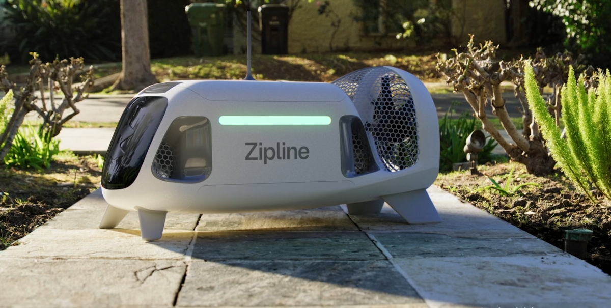
Zipline Announces 'Zip' Drones for Precise, Autonomous Deliveries

By: Alex Passett    3/31/2023

Zipline's "Zip" delivery drones are next-gen, virtually silent machines that are expected to deliver up to seven times faster than traditional automob…

Read More

Modeshift Partners with LTCA for Smart Ticketing

By: Stefania Viscusi    11/17/2022

Modeshift's smart transit solution has been adopted by Luzerne County Transportation Authority (LCTA) in the Wilkes-Barre, PA.

Read More

Video-Based Safety and AI Technology Can Reduce Truck Accidents

By: Tracey E. Schelmetic    11/15/2022

IoT solutions with video-based safety and AI technology can help reduce the likelihood of accidents by identifying distracted and aggressive driving.

Read More

Upward Mobility: Urban Movement Labs Joins Smart City Venture Studios as New Agency Partner

By: Matthew Vulpis    2/24/2022

The technology developed to create "smart cities" can make communities more effective and efficient in the use of resources, a necessity given the pro…

Read More

Up, Up, and Away - With Your IoT Data?

By: Special Guest    2/4/2021

Times have changed in the amazing world of the Internet of things (IoT). What once was a new and compelling idea has quickly worked its way into the h…

Read More